The Diocese of Sale is located in the Gippsland region in the south-eastern part of Victoria with the rural city of Sale being the Cathedral centre. Our Diocese stretches from the outer Melbourne suburbs of Narre Warren, Berwick and Cranbourne in the west to the NSW border in the east.
The southern boundary of the diocese follows the Gippsland coast from Phillip Island in the west to the border near Mallacoota in the east. Mainland Australia's southernmost point Wilson's Promontory and the famous Ninety Mile Beach form part of this boundary.
To the north the boundary skirts the Dandenong Ranges and roughly follows the top of the Great Dividing Range before crossing over to include the small communities of Benambra and Omeo and then meeting the NSW border and following it to the sea.
Most of the northern and eastern part of the diocese comprises mountains and forests with the remainder being cleared agricultural land interspersed along its two main highways by a succession of towns.
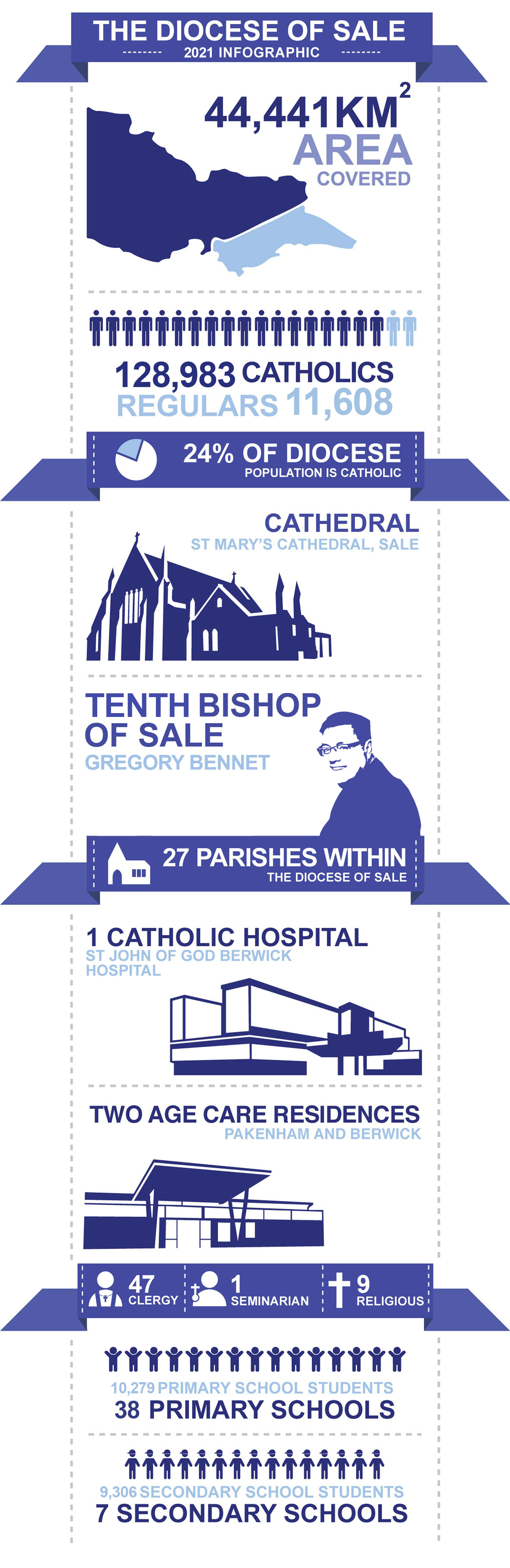
The diocese is divided into 27 parishes with several of these being parishes which share administration services and/or a parish priest.
The number of Catholics within this area of Victoria is over 128,983, which is around 24% of the region’s population. There are around 11,608 Catholics attending regular Mass.
Within diocese, there are around 10,279 students spread across 38 Catholic primary schools. In addition, there are 9,306 students spread attending 7 Catholic secondary colleges.
Our diocese is also home to 47 clergy.